


Lake Powell Map App app for iPhone and iPad
Developer: No Signal Apps, LLC
First release : 28 Oct 2012
App size: 19.93 Mb
Complete Replacement for your paper map of Lake Powell.
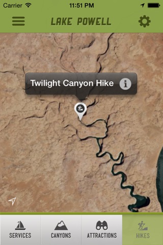
Follow your exact location anywhere on the lake without cell service or internet connection.(blue dot)
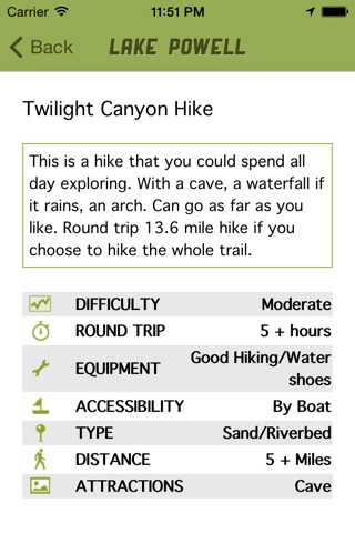
Full high resolution map with every canyon, cove, and attraction labeled that can be filtered to show from one category to all categories. (services, canyons, attractions, hikes)
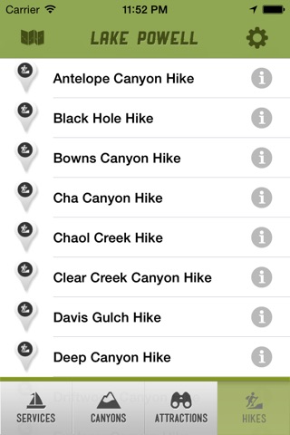
Use an alphabetical list view to easily find a specific hike, attraction, canyon, or service (restroom, marina, launch ramp) and then see it on the map.
100% Offline (no internet, cell service, nothing)
Offline (No Internet Connection Required) GPS Enabled High Resolution Satellite Map of Lake Powell
Follow your exact position on a high definition satellite map anywhere along lake powell’s 2000 miles of shore line.
Includes Map Filters and Searches for Canyons, Attractions, Hikes, and Lake Services.
No need for a bulky paper map of Lake Powell
The ultimate offline mobile app for Lake Powell.
Get every inch of the 2000 miles of Lake Powell shore line in high definition satellite imagery without being connected to the internet.